Started 2013-02-10 13:50:39 with Queries Performed: 9643 totaling 943.66 MB
Earth and Science Research (ESR) has a world-wide simulation of Ocean Surface Currents in
Real-Time (OSCAR) which has been running since 1992. They
have been modifying and testing the model for many years and are currently funded by
NASA (previously funded by NOAA).
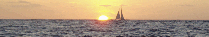
For people with low-band width internet access, like sailboats,
accessing and using their on-line data
is not easy.
I setup a set of tools to convert their daily simulated results
into a format called GRIB which can be viewed by many weather
tools such as ViewFax
(windows only, but runs under WINE on Linux). Older versions of ViewFax might not show any data -- upgrade to at least Version 5.0.56. To access this data I setup
a email responder just like saildocs.
OSCAR data covers much of the world from 80N to 80S,
spanning the globe from 180W to 180E. The resolution is in improved 0.25 degree increments.
The time-frame is a 5 day resolution with daily iterations and works well for many ocean trends.
Once a day, usually at midnight Pacific Standard Time, the Seattle
office updates their simulation of ocean surface currents. This
snapshot represents their best estimation of what the ocean surface current is
doing. They use a number of techniques and data sources for estimating ocean
current flow. If you would like to see how their model compares to real
data try reading Validation
and Error Analysis of OSCAR Seasurface Currents written in 2006.
How to Get the Data
You can retrieve the data by email using the following steps. Remember these are ocean currents,
so the model does not extend to the shore line and are more accurate for the open ocean.
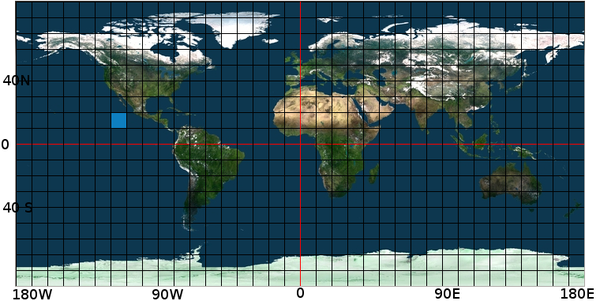
- Make Latitude and Longitude Box.
- Email "query (at) svsarana.com" with message: oscar:lat1,lat2,lon1,lon2
- Wait 30-60 seconds for an email response.
- View the attached data with a grib viewer (Not all viewers display current)
- See some examples.
Back to Top
The globe is split up into grids with lines running North-South and East-West.
To define a box on the earth's surface specify your latitude in degrees, say 20N and 10N.
Then limit the east-west sides of the box with your latitude, for example 120W to 110W.
Use these corners to fill in the OSCAR command: oscar:lat1,lat2,lon1,lon2. In this example
the command becomes:
oscar:20N,10N,120W,110W
The area is shown highlighted on this map.
Back to Top
Now that you know your target area, send the request in the message body to "query (at) svsarana.com"
oscar:20N,10N,130W,120W
Note the subject is ignored.
Back to Top
You will receive an email response with information about the GRIB file including it's origin.
The attachment will contain the grib file for your requested area.
OSCAR2.0 (Ocean Surface Current Analysis Near Real-Time) contains near-surface ocean current estimates, derived using various satellites and in situ instruments. Data are on a 1/4 degree grid with a 5 day resolution.  All data is generated by computer models subject to error.  Use data at your own risk.

For additional information see https://svsarana.com/oscar
Data extracted from oscar_currents_nrt_20251016.nc last updated 2025-10-19 08:11:41 UTC
Back to Top
With Airmail's email program for HF radios, you can just click on the attachment and ViewFax (version 5.0.56 or newer) will
start and display the data. Otherwise, save the attachment and open your GRIB viewer. In your viewer
you'll need to open the saved attachment "OSCAR-xxxxxxxx.grb" file to view it.
You can mouse over the current arrows in ViewFax to get direction and speed.
Back to Top
Here are several examples of what to expect when using OSCAR data.
OUTSIDE BAJA
For the Outside of Baja Mexico send this request to query (at) svsarana.com
oscar:32N,20N,120W,110W
You'll get back a 5.2KB file that will look like the following in your viewer.
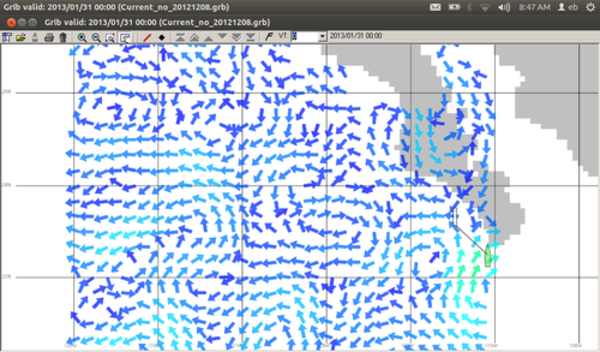
The data near shore is not perfectly clipped to the shoreline but it gives you a
good idea of what is happening offshore.
MAIN-LAND MEXICO
For the Main Land of Mexico send this request to query (at) svsarana.com
oscar:25N,15N,110W,93W
You'll get back a 4.6KB file that will look like the following in your viewer.
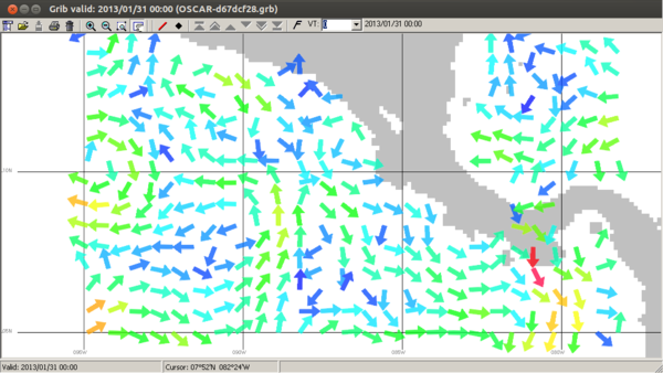
CENTRAL AMERICA
For Central America send this request to query (at) svsarana.com
oscar:15N,5N,95W,78W
You'll get back a 7.6KB file that will look like the following in your viewer.
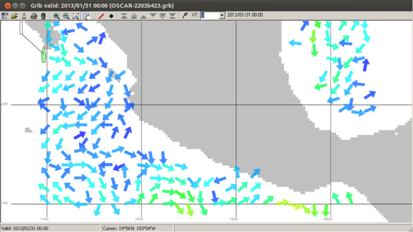
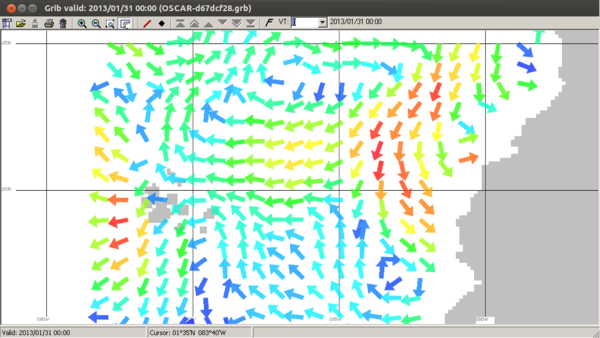
ECUADOR-GALAPAGOS
Where OSCAR really shines for sailors is in highlighting the equatorial and counter
equatorial currents. For example the passage from Panama to Ecuador or the Galapagos.
oscar:5N,5S,93W,77W
The 7.2KB file reveals areas of stronger currents.
Back to Top
Additional Resources
There are not many current models to compare. However NOAA
has an Atlantic Model that can be fetched from "query (at) saildocs.com"
NOTE this is not svsarana.com! Use the command "rtofs:lat1,lat2,lon1,lon2"
Additional information about OSCAR can be found at NOAA.